
League City Neighbors by Block
The public block trail is parcel-based. Start at the target lot, identify the lots that touch it, and then open each parcel record. That method can establish the physical lots around a League City address and the indexed owner or tax information tied to each one. It cannot establish a complete list of nearby households. The table separates the official sources from social and historical context, so a block question stays within what each record really shows.
| Block source | What it can show nearby | How it is accessed |
|---|---|---|
| GCAD map and eSearch | Parcels, lot lines, indexed owner/tax fields, situs, mailing address, and identifiers | Free public map and search, with map disclaimers. |
| County AVA recordings | Transfers, encumbrances, and legal descriptions for a specific parcel | County-linked portal, counter, or certified-copy request. |
| Texas voter route | A named person's registration status and precinct path where displayed | Individual lookup or an official file request with protections. |
| City permits and code records | Project chronology or a specified case record for an address | EnerGov route, map, or narrow public-information request. |
| HOA Alliance and city events | Community contact route and neighborhood names used by the city | Public city information, not a member roster. |
| Helen Hall and GTHC | Older address, directory, and community context | Library or Reading Room research; coverage varies. |
An adjacent parcel and a tax-roll owner are not the same thing as a current occupant. A tax mailing address may point to an agent, business, lender, or another address. A homestead flag is evidence tied to a principal-residence exemption, but it is not a full household list. Preserve the parcel's Geographic ID and legal description before moving to a deed or civic source. These stable keys reduce the chance of mixing up nearby lots with similar street labels.
League City Neighbor Parcels
The Galveston County Interactive County Map and GCAD GIS data provide the spatial layer for a League City neighbor question. They show parcels, lot lines, street centerlines, subdivisions, city boundaries, MUDs, WCIDs, and neighborhood map material. The county viewer requires its terms acknowledgement and warns that boundaries are approximate and informational, not a legal survey. Use the map to identify the next parcel, then confirm the parcel's fields in eSearch.
The live map supports browsing and identify or query functions, but the inspected sources did not verify a particular adjacent-lot or radius button. Do not estimate a property boundary from a screen capture. When a line is unclear, compare lot-line and subdivision data, a county plat, or the parcel's legal description. Map labels are valuable navigation aids. They are not deed evidence, and a label should never become a claim about who lives on the land.
League City Neighbor Voter Limits
A voter search is not an official block roster. Texas's individual route is built for a named person using a VUID, Texas driver-license or ID information if provided, or first and last name. It can return registration and polling-place guidance. The public voter information is subject to confidentiality rules, and a protected voter can have an address suppressed or replaced. Registration status does not reveal a ballot choice.
The Secretary of State's full-file request has a different, formal path. It requires a request form, a complete physical address, an affidavit, delivery selection, and a deposit, with rules for permitted reductions and protected data. It can include precinct and participation fields, but that does not turn it into a casual list for a League City block. Phone numbers, Social Security numbers, and driver-license data remain restricted. Use precinct geography to understand an election area, not to identify a block's private households.
Note: A missing voter address can reflect a statutory protection or a separate record rule, rather than an error in the map.
League City Neighbor Contacts
Community sources work best as contact paths, not as resident lists. A 2022 city National Night Out announcement named places such as Oak Manor, Old League City, Tuscan Lakes, Bay Colony, Magnolia Creek, and Westover Park. Those are useful names to test in city agenda and archive searches, but the announcement is a historical event list. It does not establish current boundaries, membership, or contact details for each area.
The League City HOA Alliance is the documented umbrella route. A city news item says the alliance has existed since 2013 and that more than two dozen representatives attended a quarterly meeting in May 2023. The cited material does not publish member rosters, so use it to reach civic contacts rather than to infer which household belongs to an association.
| Community contact | Documented route and limit |
|---|---|
| League City HOA Alliance | Nonmember HOA contact: txtcher@aol.com or 832-407-5130. The cited city source does not supply a member directory. |
| City community contact | Community Engagement Manager Amber Pedigo: Amber.Pedigo@leaguecitytx.gov, listed in the May 2023 city item. |
| City Agenda Center | Search by keyword, date range, time period, and category for public neighborhood issues and meetings. |
| League City Historical Society | Historic sites, registries, exhibits, and newsletters offer place context, not a private member list. |
Map a League City Block
Follow a short parcel flow from one address to its immediate surroundings. The goal is to map legal lots and verify the owner field associated with each parcel, not to compile a list of people. Start from the physical address and preserve the identifiers that do not depend on a street spelling. If an old or unusual street label appears, the lot, subdivision, or legal description may be the more stable bridge.
- Locate the address in the county or GCAD map, zoom to show the target lot, touching parcels, lot lines, and the street.
- Record each adjoining lot's Property ID, Geographic ID, and legal description. If the map is unclear, use lot or subdivision information instead of guessing.
- Open each ID in GCAD eSearch and compare the indexed owner, situs, mailing-address distinction, exemptions, and neighborhood or subdivision fields.
- Use the legal description in the County Clerk's AVA route when a transfer chain is relevant, and record the instrument detail with the parcel notes.
For the longer record chain along a named road, use the League City by-street directory. A whole road can cross several subdivisions and municipal areas, while this method stays focused on the lots that immediately touch the target parcel.
League City Block Records
Permit and code information can add an address-specific timeline without becoming a neighbor list. League City's Tyler EnerGov route supports existing permit, project, and planning-hearing searches; account users can submit, track status, inspections, and payments. A permit can identify a project, applicant or contractor, review, and inspection dates. It is not a deed and does not establish who occupies a location. For code cases, the city directs users to a public map and a specified record request when details are needed.
The League City Code Compliance page is the source for the address-specific request path.
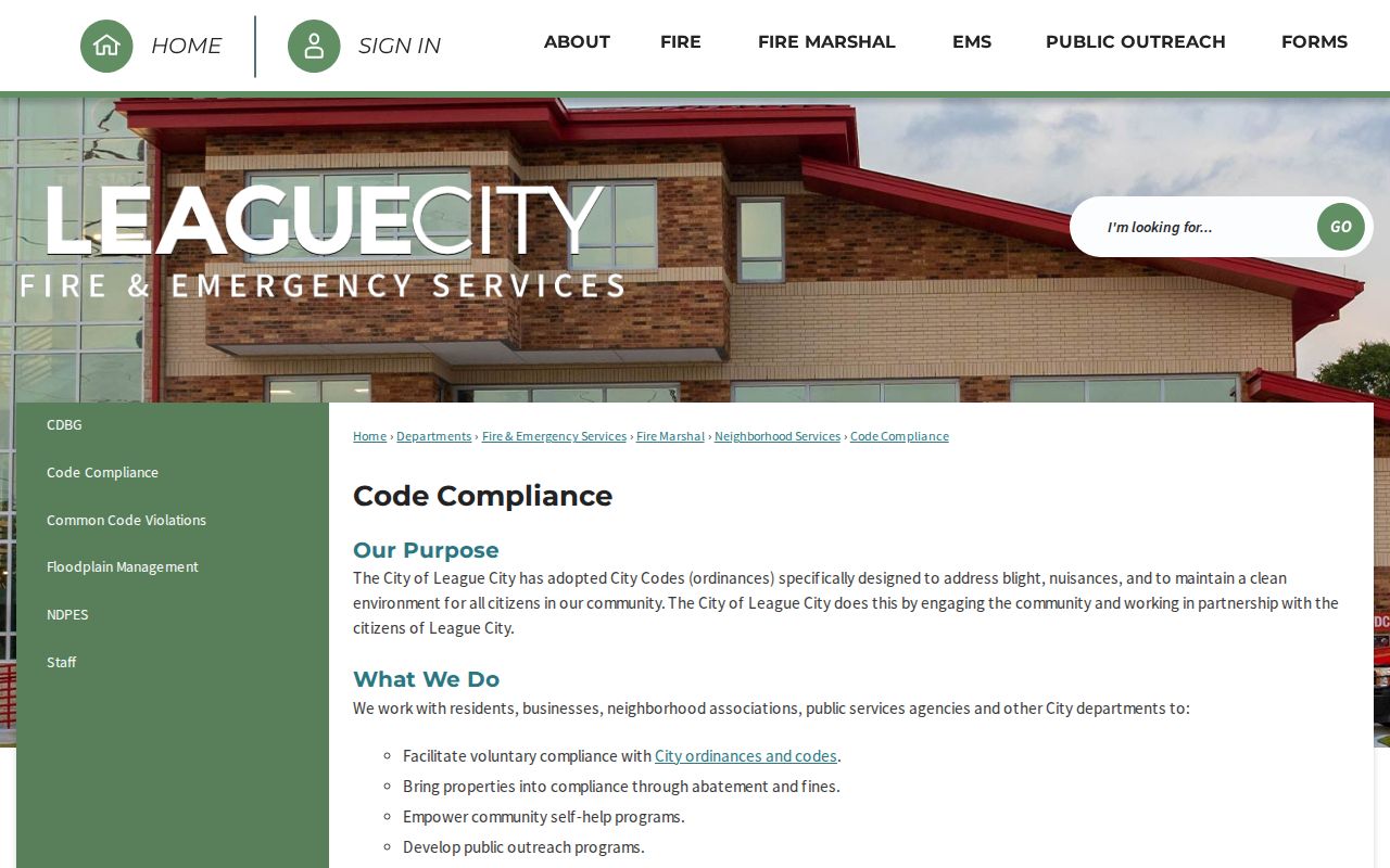
The public page supports a map view, while a request to the City Secretary should name the address, date range, and existing case record sought. The city states that specified Code Compliance requests can take up to ten business days.
League City Neighbors Compared
Official parcel records and commercial neighbor-lookup services answer different questions. The official trail names the custodian, record date, parcel identifiers, and a correction path. Commercial services can combine brokered and public-record material, but a single profile may contain stale associations or join similar names. Compare the source before relying on any claimed connection to a League City block.
| Official parcel and civic records | Commercial compiled profiles |
|---|---|
| Show the source custodian, parcel field, legal description, and date. | May combine extracts, brokered data, marketing data, and older address associations. |
| Support correction or clarification through GCAD, the clerk, City Secretary, or voter registrar. | Can repeat a stale link or merge people with the same name. |
| Establish limited record facts, such as a tax-roll owner or a filed instrument. | Do not establish occupancy or a complete block household list. |
League City Block History
The older core of League City has a practical records quirk. The historic-resources survey describes the original 1893 town east of the railroad as 42 blocks with numbered east-west streets, 50-by-140-foot lots, and alleys. It also identifies old Main Street as present-day 2nd Street. That history can explain why a deed, archive item, or directory points to a familiar block under a different street label.
Historical searches should also test Clear Creek and Clear Lake Area when League City produces no result. The post-office naming dispute ended with League City becoming official in 1902, while older materials can retain other labels. Use the map and legal description to bridge those names. A city-history or archive result provides context for the block, not an updated source for private households.
League City Neighbor Privacy
Many connections to a block are not public parcel facts. Utility customers, delivery recipients, children, visitors, protected voters, and unlisted household members do not appear through this parcel workflow. Texas's Address Confidentiality Program can provide eligible participants a substitute address, and election protections can suppress or replace a voter address. Social Security, Texas driver-license, and certain court or vital-record information have separate restrictions.
A map absence is not a reason to fill the gap with a guess. Ask the correct custodian about a parcel correction, instrument issue, specified public record, or confidentiality rule. The federal Driver's Privacy Protection Act also limits motor-vehicle personal information. Community groups can offer a public contact route, but the cited League City sources do not provide a private member or block-watch roster.
Lawful use. Use League City neighbor records for lawful personal research and civic context. Texas stalking and harassment laws apply when information is used to threaten, watch, or intimidate another person.