
League City Previous Resident Sources
For a League City address, each source answers a narrower question. The appraisal record identifies the current tax-roll parcel and its legal description. A recorded instrument can show a transfer party, the document date, and the legal description carried forward. Directories and census schedules add dated household leads. Helen Hall, GTHC, and TSLAC carry the archive path once an online portal or recent record no longer reaches the period at issue. Keep the years and source labels with each finding.
| Source | Years it covers | Where held | What it shows |
|---|---|---|---|
| County Clerk deed records | 1838-1886 confirmed on TSLAC microfilm; current AVA range not stated | County Clerk, AVA, and TSLAC | Grantors, grantees, legal descriptions, instruments, and encumbrance trail |
| Galveston directories | 1859-1860 and 1866-1925 online; related formats through current | GTHC, Portal, microfilm, and Reading Room | Names, addresses, business or residence context, and other period clues |
| Clear Lake Area directories | 1969, 1971, 1972, 1974, 1976, 1977, 1979 | TSLAC reference and library verification | League City is routed to this locality heading |
| Federal census | 1790-1950; 1960 opens in 2032 | NARA and library research tools | Household, relationship, birthplace, and enumeration-area context |
| League City permits | Current EnerGov history; earliest public year not stated | City Building and EnerGov | Project, applicant or contractor, inspection, and address chronology |
Start with the source closest to the period you need. A recent ownership change normally starts with the GCAD parcel record and County Clerk index. A 19th-century transfer may need microfilm. A family question between those points may need the Clear Lake Area directory label, a historical newspaper, or a public census schedule. Previous residents are not established merely because a name appears once in an address-related file.
League City Parcel Facts First
Preserve the modern parcel record before moving backward. GCAD eSearch can search by owner, street number, simple street name, Property ID, Geographic ID, subdivision, neighborhood, and other appraisal fields. Copy the Property ID, Geographic ID, situs address, mailing address, legal description, subdivision or lot/block wording, and indexed owner together. The assessment record is not a deed and does not prove every person who lived at the address.
A situs address is the physical parcel. A mailing address is where appraisal correspondence goes, and it may belong to an agent, lender, business, or another place. The legal description is the title-oriented parcel wording. It is the most durable bridge when a street changes form or an old document names only a lot, block, abstract, or metes-and-bounds tract. The process is address and GCAD identifiers, then legal description, then recorded instrument, then the prior party and instrument.
GCAD advises users to enter a simple street name without a prefix, suffix, or unit number when its street field needs help. Its legal-description and acreage disclaimer also matters: the portal is for research and is not a survey. Use the county map to orient the parcel, but confirm ownership in the appraisal record and a recorded instrument.
Follow the Galveston County Deed Chain
The deed chain begins with the current owner as grantee, meaning the person or entity that received an interest in the document. Locate that acquisition in the County Clerk's real-property records, then read the seller or grantor, legal description, instrument number, recording date, and any prior-document reference. Search the seller as grantee to locate that person's acquisition. Repeating the direction turns a present parcel into a backward title trail.
- Open the GCAD parcel card and copy the exact legal description, Property ID, Geographic ID, current indexed owner, and situs address.
- Search the current owner in the County Clerk real-property index and identify the conveyance that matches the legal description.
- Record the named grantor, grantee, instrument date and recording date when shown, document number, and prior-instrument reference.
- Search the grantor as a grantee for the acquisition of the same parcel, using subdivision, lot/block, spouse or party names, and dates to separate common names.
- Repeat until the portal stops, then use a named County Clerk request, certified-copy route, counter research, or the TSLAC microfilm fallback.
- Grantor / grantee
- The grantor transfers an interest. The grantee receives it. Those roles can reverse in the next deed.
- Chain of title
- A sequence of recorded transfers and related instruments tied to the same legal parcel, not a complete list of everyone who lived there.
- Legal description
- The parcel wording used for title, such as lot and block or a metes-and-bounds description. It is often more reliable than an old street label.
A mortgage release, lien, probate transfer, divorce filing, foreclosure, or entity transaction may explain a name change without an ordinary sale. An owner's mailing address can suggest a later connection, but it is tax-mail evidence only. It should never be rewritten as a confirmed residence.
League City AVA and Microfilm Stops
The county's AVA real-property portal is the current online route, but the official county hub does not publish a complete earliest online year. Do not invent a cutoff. The reliable statement is current County Clerk portal access plus Galveston County deed microfilm for 1838-1886 at the State Library. The county-clerk finding aid also identifies property-related records through 1982 in its historical subseries.
The county-linked AVA search landing page is the online starting point for a current instrument trail.
If a needed deed is older than the visible online trail, ask the County Clerk for a named instrument or use the county-linked copy route. Texas State Library and Archives material is available in Austin and through interlibrary loan, with some items digitized through FamilySearch. That fallback is more useful than treating a portal gap as proof that an earlier transfer does not exist.
League City Past Residents in Directories
Once the deed chain supplies an earlier owner or date, the household layer can begin. The League City city-directory collections identify the regional shelves, digitized runs, and Clear Lake Area label used for selected local years. Directories can link a name to a residence, business, or boarding notation at a point in time, but a complete League City reverse or criss-cross run has not been confirmed. Ask the GTHC Reading Room whether the relevant volume has an address section.
GTHC's house and property research guide brings deeds, directories, maps, photographs, and archives into one research sequence.
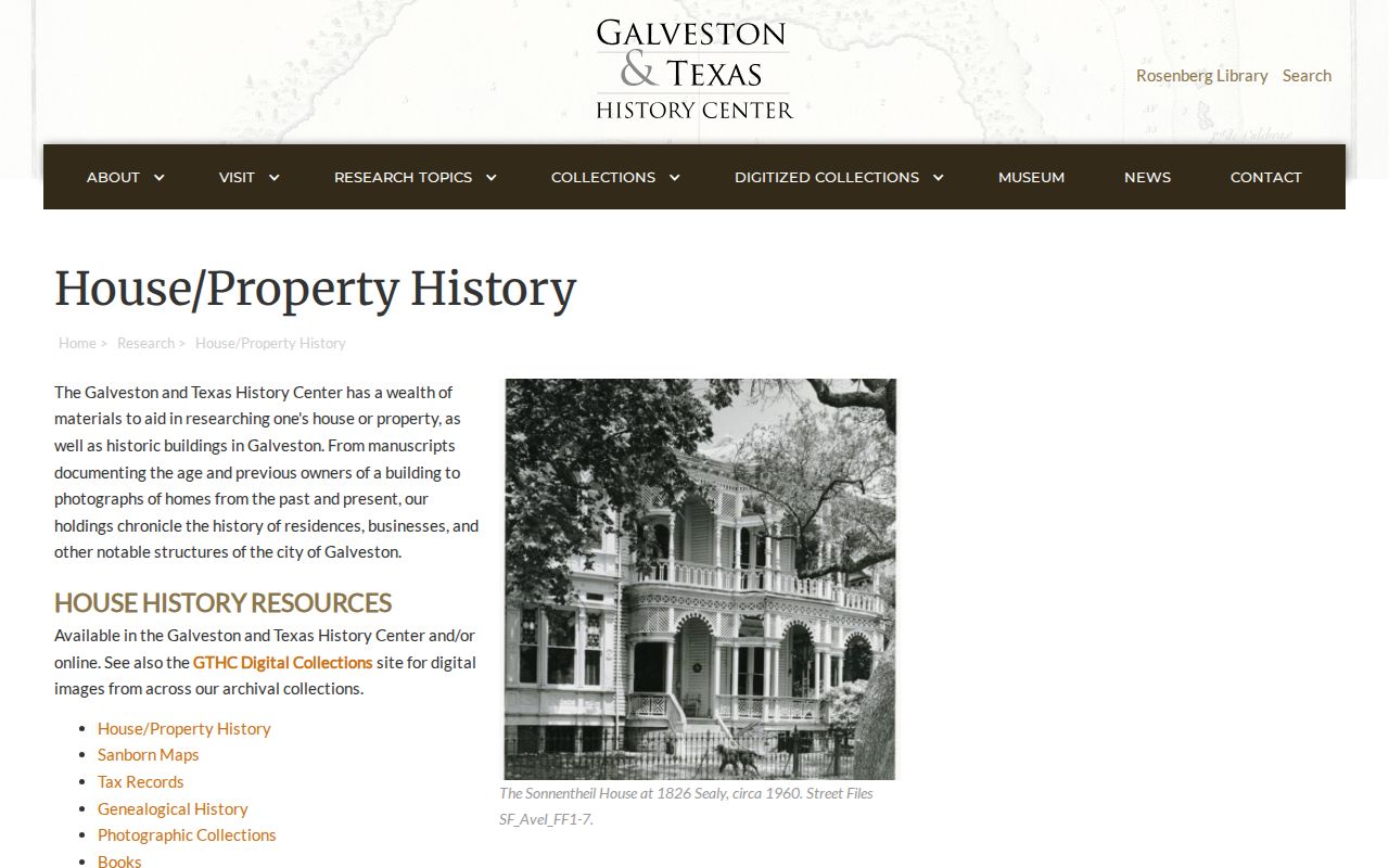
The guide notes that newer subdivisions and other Galveston County regions may be available. Pair its sources instead of letting a directory line carry the whole claim. A permit can place project activity at an address. Historic aerial imagery, GCAD improvement data, and a historic-survey photo can help date a structure. None alone identifies a full household.
Pair League City Directories and Census
A census can test a directory lead by showing people enumerated together on a particular date. The federal 72-year rule makes the 1950 census the latest public full census, and the 1960 schedule opens in April 2032. Search the nearest directory years around the census year, then compare the locality name, street or enumeration context, age, relationship, birthplace, and other facts that the schedule actually shows.
- Copy the directory year, page, locality heading, name spelling, address wording, and any relationship or residence notation.
- Find the closest public census year and preserve the enumeration district or address context rather than assuming a modern municipal boundary.
- Compare only independent details, such as names, ages, family relationships, locality labels, and the sequence of directory addresses.
- Use a deed or property record to keep the household clue separate from a title transfer.
The 1890 census was mostly destroyed in the 1921 Commerce Department fire. For that gap, try tax records, deeds, directories, newspapers, probate, church material, or cemetery sources. A 1950 entry may also use a rural enumeration district or locality label that does not match a present League City boundary.
League City Main Street Bridge
Historic address work has a concrete League City trap: old Main Street is now 2nd Street. The historic survey places the original 1893 town east of the railroad in a numbered-street grid. It also records the Clear Creek and League City naming dispute, with League City becoming official in 1902. Search both street names and both locality labels when a historic deed, directory, or newspaper appears to miss the modern address.
The survey research method combined aerial imagery, GCAD improvement data, newspapers, printed sources, and League City Historical Society material. Its records reportedly include at least two photographs per historic-resource record. That combination is a better test for an older house than guessing from a current street map. No citywide renumbering table or complete annexation readdressing table was located, so retain the old wording in every research note.
League City Household Trail Endpoints
Past residents can disappear from the address trail for many reasons. An obituary may identify death, relatives, a last-known locality, or a civic connection. Probate can identify heirs, fiduciaries, and a property relationship, although sealed or protected material can remain unavailable. Helen Hall's digitized Citizen microfilm, GTHC genealogy resources, cemetery transcriptions, and County Clerk probate routes are the useful next channels when a deed provides an owner but not a household answer.
The TSLAC Galveston County microfilm inventory identifies the confirmed older deed, tax, probate, marriage, voter, naturalization, and court material that can bridge a missing directory period.

TSLAC lists deed records from 1838-1886, tax rolls from 1838-1910, probate minutes from 1838-1906, and other county series. These archival records provide dated evidence, but they are not a shortcut to a current address. Note: A record trail should stop at the evidence available, especially when a person or address is protected by law.